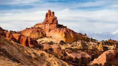
| Skip Navigation | |||
|
Disturbances
in the Delta: Understanding New Orleans’ Geology |
|||||||||||||||
|
Numerous processes contribute to New Orleans’ perilous geologic situation. The city, and much of southern Louisiana, is located on the Mississippi River delta. The delta has been built over many thousands of years by sediment carried in suspension to the mouth of the river and dumped as the river flow slows and enters the Gulf of Mexico. The floodwater-deposited sediments, upon which New Orleans is built, naturally compact and settle over time. The Mississippi River currently carries a reduced sediment load due to numerous dams and flood-control projects, thereby limiting the sediment replenishment in the delta. Along the river margin, levees channel water and sediment away from the sinking marshlands, and the coastline becomes starved for sand. As a result, wetlands and marshes are disappearing and the natural buffer against storms and hurricanes is lost. Proposed solutions to these issues involve returning river water flows and sediment to wetlands, rebuilding barrier islands and bars, and constructing floodgates where needed. Sediment Supply and Demand While the Mississippi still carries large sediment loads, the amount of sediment today is only about 40 percent of the sediment load compared to a few hundred years ago. Dams and flood control structures create obstructions that trap sediment and reduce the river’s sediment load. Twenty-seven dams and locks exist on the Mississippi between New Orleans and Minneapolis, and exist primarily to enhance shipping. Other dams and large reservoirs are present on tributaries, particularly the Missouri. Each large reservoir allows suspended sediment to settle and remain in the reservoir instead of proceeding downstream. In the delta, the reduced sediment supply cannot fully replenish a delta built and dependent on a higher volume of sediment influx. Sinking City This natural compaction process causes the delta sediments to settle and sink, with New Orleans sinking along with it. While the site of New Orleans was above sea level when it was first settled, much of New Orleans is now below sea level. From the age of the city of New Orleans, we can guess that this settling amounts to something like one foot every 10 or 20 years. The settling is not reversible, and normally would be halted by renewed sediment deposition in the lowest areas. However, annual flooding and sediment replenishment are obviously not compatible with a stable, vibrant city. Levees and Lobes Additionally, the current main channel ends very near the edge of the continental shelf, and water depths increase rapidly offshore. Sediment dumped at the current channel mouth goes over the continental margin and is lost to near-shore marginal environments. This is especially apparent in offshore barrier islands and bars that serve to protect the coast from storms. The barrier islands are starved for sand and are shrinking in size. Vanishing Wetlands Geologists at the U.S. Geological Survey have recently suggested that withdrawal of oil and gas fluids from the subsurface has also contributed to surface settling. Withdrawal of fluids depressurizes the subsurface, which may allow surface settling. In an analogous way, withdrawal of groundwater in other areas often results in well-documented surface subsidence. The area of Louisiana wetlands naturally disappearing in this way is about 30 square miles per year and possibly 1,900 square miles so far. The rate of wetlands loss does not seem to be slowing, and if action is not taken, the loss will probably continue at this rate. The wetlands form a critical buffer between the settled coastline and the Gulf of Mexico, and besides providing rich wildlife habitat, have the ability to absorb and moderate storm impacts. Three to four miles of wetlands are able to absorb about one foot of storm surge. Wetlands provide water storage areas and the vegetation absorbs wave energy. Some wetlands after storms are rumpled like a floor rug, thereby showing how much energy they can absorb. Restoration Recommendations The first recommendation was to divert Mississippi River water and sediment into sinking marshland through new channels cut into the south side of the constraining levee system. Dredging was suggested to rebuild and restore the offshore barrier islands. Dredging the current mouth of the river was to be abandoned to allow the current channel to fill with sediment and promote lobe switching. It was suggested a new shipping channel be built farther inland and the current shipping channel be closed. And lastly, the report recommended building a gating system to control seawater access to Lake Pontchartrain. Pilot projects under way show that some of these suggestions are working; some others have been successfully implemented overseas. The cost of all the suggested projects was $14 billion, a figure that now looks like a bargain.
|
||||||||||||||||
Apply Financial Aid Visit Campus Request Info. |
About Calvin Giving to Calvin Hekman Library Contact Calvin |
Majors & Minors A-Z Index People at Calvin Calvin's website |
Spark |
|